Maine. Circumnavigating Acadia’s Mount Desert Island
Dubbed “crown jewel of the North Atlantic Coast,” Acadia National Park had been on my bucket list for decades. I would have visited long ago except for its position in the northeastern corner of the U.S. Located near Bar Harbor, Maine, the 198 square kilometer park includes Mount Desert Island, the Schoodic Peninsula, and several small islands. Within its boundaries are U-shaped valleys, cobblestone beaches, meadows, pine forests, and massive domes of exposed granite. The park’s loop road is used for bicycling, horseback riding, and car/bus tours. Other popular activities include kayaking, canoeing, rock climbing, and bird watching. The park’s roads and overlooks offer spectacular views of pristine lakes, rocky sections of the Atlantic Ocean coastline, and tree-covered islands. Park visitors can also visit Cadillac Mountain (470m), named after the French explorer Antoin de la Mothe Cadillac. Of note is Acadia’s status as among the first places in the U.S. to experience sunrise each day. Today, the park receives about four million visitors each year.
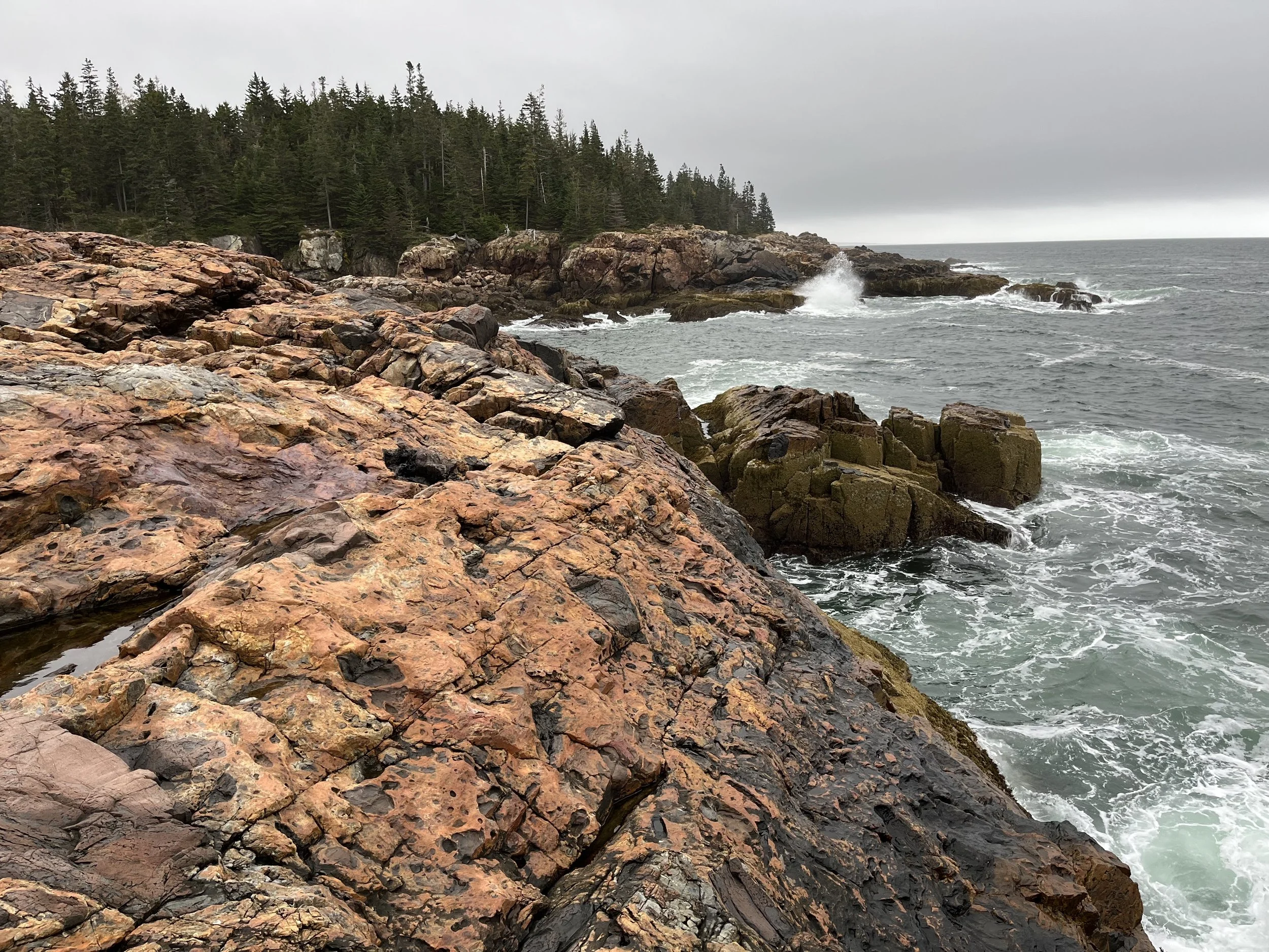
The region has a fascinating geological history. Two to three million years ago a 1,500-meter-thick ice sheet moved slowly across Mount Desert Island, rounding off mountaintops and deepening valleys. The final period of glaciation ended about 10,000 years ago. As the climate warmed and the ice melted, massive boulders were left behind along with rocky headlands and stony beaches. There were also sea caves and sheltered coves such as Sand Beach with fine grained particles ground from shells and other marine life. A central feature of the park is where a glacial fjord split a mountain range, creating Mount Desert Island. The park also has diverse vegetation and animal life with northern boreal forest, eastern deciduous forest, marshes and swamps, and tidal zones. Common trees are spruce-fir, oak, maple, jack pine, and balsam fir. Other plants are the starflower, lowland blueberry, and Canadian bunchberry. The park’s range of animals includes black bear, red fox, American mink, groundhog, and North American river otter.
A larger region that includes the park was occupied by Wabanaki people as far back as 10,000 years ago. There were a few hundred people living on Mount Desert Island in 1604 when French geographer and explorer Samuel de Champlain named it Isle de Monts Deserts (island of barren mountains). In 1688 the island was gifted to the adventurer and explorer Antoine de la Mothe Cadillac by French King Louis XIV. The area remained under French control until 1713 when it was ceded to England. Fur traders and other Europeans began arriving during the 17th century and by the 19th century, the area was a get-away for wealthy families and a destination for writers and artists such as painter Thomas Cole. Vacationers using the island included Fords, Rockefellers, Carnegies, and Morgans. Financed by John D. Rockefeller, Jr., an extensive network of crushed stone carriage roads was built between 1915 and 1940.
The idea for a park was first suggested by architect Charles Eliot. However, park advocate and conservationist George B. Dorr was most instrumental in helping establish the national monument. In 1916 the area was designated Sieur de Montes National Monument and three years later redesignated Lafayette National Park in honor of French participants in the Revolutionary War. Lafayette was the first national park created east of the Mississippi River and the first to be established on land donated to the government. In 1929, its name was changed to Acadia National Park in recognition of the former French colony of Acadia that once included Maine. The name change was also a compromise intended to appease anglophiles who eventually donated the Schoodic Peninsula.
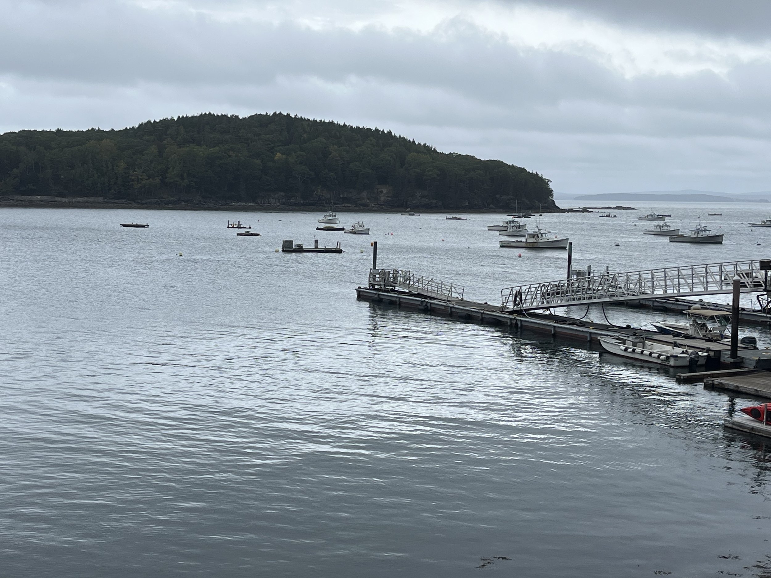
We arrived at the park via Highway 1. From Ellsworth we followed State Highway 3 southeast to Bar Harbor. Bar Harbor (population 5,100) is on the site of a Wabanaki hunting and fishing camp. In 1604, Champlain stopped there to repair his boat after running aground. In 1761 the European village of Somesville was established on the site with an economy centered on fishing and shipbuilding. The city was first incorporated as “Eden” in 1796 and renamed “Bar Harbor” in 1918. Today, the town is famous for lobster shacks, whale watching, and sailing. We ate at a seafood restaurant called Stowman’s and then browsed shops on Main and West Streets. After lunch we followed the 43-kilometer Park Loop Road which begins near Bar Harbor on the east side of Mt. Desert Island and proceeds in a one-way clockwise direction around the island. The route took us by a large pond called the Tarn and then Champlain Mountain, Sand Beach, Thunder Hole, Seal Harbor, the Bubbles, and Eagle Lake. One of the most scenic stops was the iconic Bass Harbor Head Light Station, located at the entrance to Bass Harbor and Blue Hill Bay. Completed in 1876 and sitting at the top of a bluff overlooking the coast, the station is equipped with a fog bell and high intensity light. Today, it is used as a private residence for a coastguard employee and his/her family. It took about ten minutes to walk from the parking lot to the light station and the adjacent overlook. Of note, the lighthouse was featured on an America the Beautiful quarter (U.S. National Park Service sites) in 2012.
Another stop was Thunder Hole, an inlet where water forced into a narrow channel creates a loud noise and geyser-like gush of water. One to two hours before high tide is the ideal time to experience this “blowhole” that sends ocean spray to heights of up to twelve meters. Thunder Hole was mentioned in Clara Barn Martin’s 1867, Guide Book for Mount Desert Island. Martin described it as “…a deep chasm into which with every returning wave the water rolls and swirls…” That night we camped at Sea Wall, a National Park Service campground positioned on a loop road that is accessible from Highway 102.


