Texas. Canyons, Cadillacs, and Cowboys
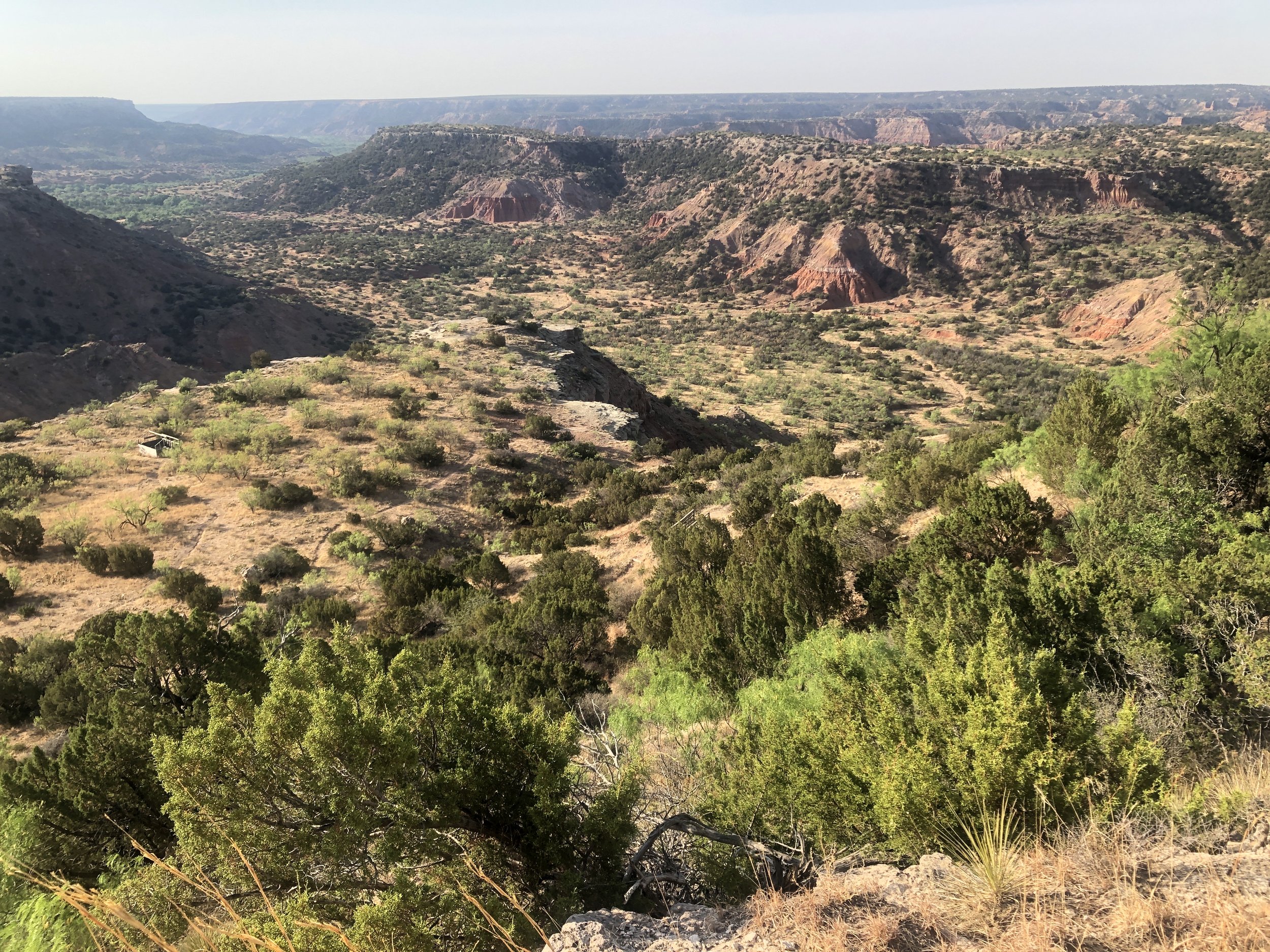
America’s second largest canyon is in an unlikely place. Located in the Texas Panhandle southeast of Amarillo, Palo Duro Canyon’s “head” (origin) is twenty-four kilometers south of Amarillo. From there it extends 193 kilometers southeast through Randall, Armstrong, and Briscoe counties. The canyon’s maximum depth is 244 meters, measured from rim to bottom. In comparison, the Grand Canyon is 446 kilometers long and reaches a maximum depth of 1,828 meters.
Like the Grand Canyon, Palo Duro was created by fluvial (water) erosion. Meandering along the surface of West Texas’ Llano Escarpment, the Prairie Dog Town Fork of the Red River cuts into layers of sedimentary rock formed 240 million years ago when the area was covered by an inland sea. It is believed that the process responsible for creating the canyon has taken more than ninety million years. Today, the canyon’s sides appear as layers of red, brown, yellow, gray, and white rock. Topped by a durable caprock, the canyon also features buttes, pinnacles, mesas, and hoodoos. Animals found in the canyon area include the Palo Duro mouse, mule deer, cottontail rabbit, and Bullock’s oriole. Some common types of canyon vegetation are western soapberry, mesquite, red berry juniper, and willow
Palo Duro Canyon has been inhabited for more than 12,000 years beginning with Folsom peoples who hunted bison and mammoth. It is believed that members of a Spanish expedition led by Francisco Vázquez de Coronado saw the canyon in 1541. The words “palo duro” mean “hardwood” in Spanish. Nomadic Kiowa, Comanche, and Apache are also known to have camped in the canyon. In 1852, U.S. Army Captain Randolph B. Macy led a group through the canyon in search of the source of the Red River. Other visitors were Comancheros from New Mexico who traded with Native Americans. The canyon was the site of skirmishes between the U.S. Army and Southern Plains Indians such as the Battle of Palo Duro (September 28, 1874), part of the larger Red River War (1874-1875). The battle involved a surprise attack by the U.S. 4th Calvary on an encampment of Comanche, Cheyenne, and Kiowa. In 1876, former Texas Ranger Charles Goodnight drove 1,600 head of cattle into the canyon. By 1885, Goodnight’s JA Ranch had expanded to more than 100,000 head of cattle on the largest privately owned estate within the canyon.
Along with its value for grazing cattle and sheep, the canyon became a popular location for picnicking and camping. In 1933, the State of Texas bought land for a park and soon after the Civilian Conservation Corps (CCC) began work on a road from the rim to the canyon floor in what is today, Palo Duro Canyon State Park. CCC crews also built El Coronado Lodge (now the park visitor center) and cabins located on the rim and canyon floor. Artist Georgia O’Keeffe, who lived in Amarillo, was fond of painting landscape scenes within the canyon. Dubbed, the “Grand Canyon of Texas,” the park now hosts 400,000 visitors each year. From Amarillo we drove south on Interstate 27 and then east on Highway 217. Stopping briefly at the visitor center, we reached a parking lot adjacent to the Goodnight Peak Loop Trail. Our hike downward from the rim to the canyon floor took us through thick areas of juniper, yucca, and mesquite. Near the bottom, were water-dependent cottonwood trees and salt cedar. Returning to our car, we followed the park road past Cow Camp Cabins. A short trail took us to an area of badlands with sandstone caves and mushroom-shaped rock pinnacles. Completing the loop road, we returned to Highway 217. On our way back to Amarillo, we stopped at the Helium Time Columns Monument. Built in 1968, the monument commemorates the 100th anniversary of the discovery of helium. Located about twenty kilometers northwest of Amarillo, the Federal Helium Reserve once held more than a billion cubic meters of helium. A 1996 law directed the federal government to phase out the reserve and sell the remaining helium.
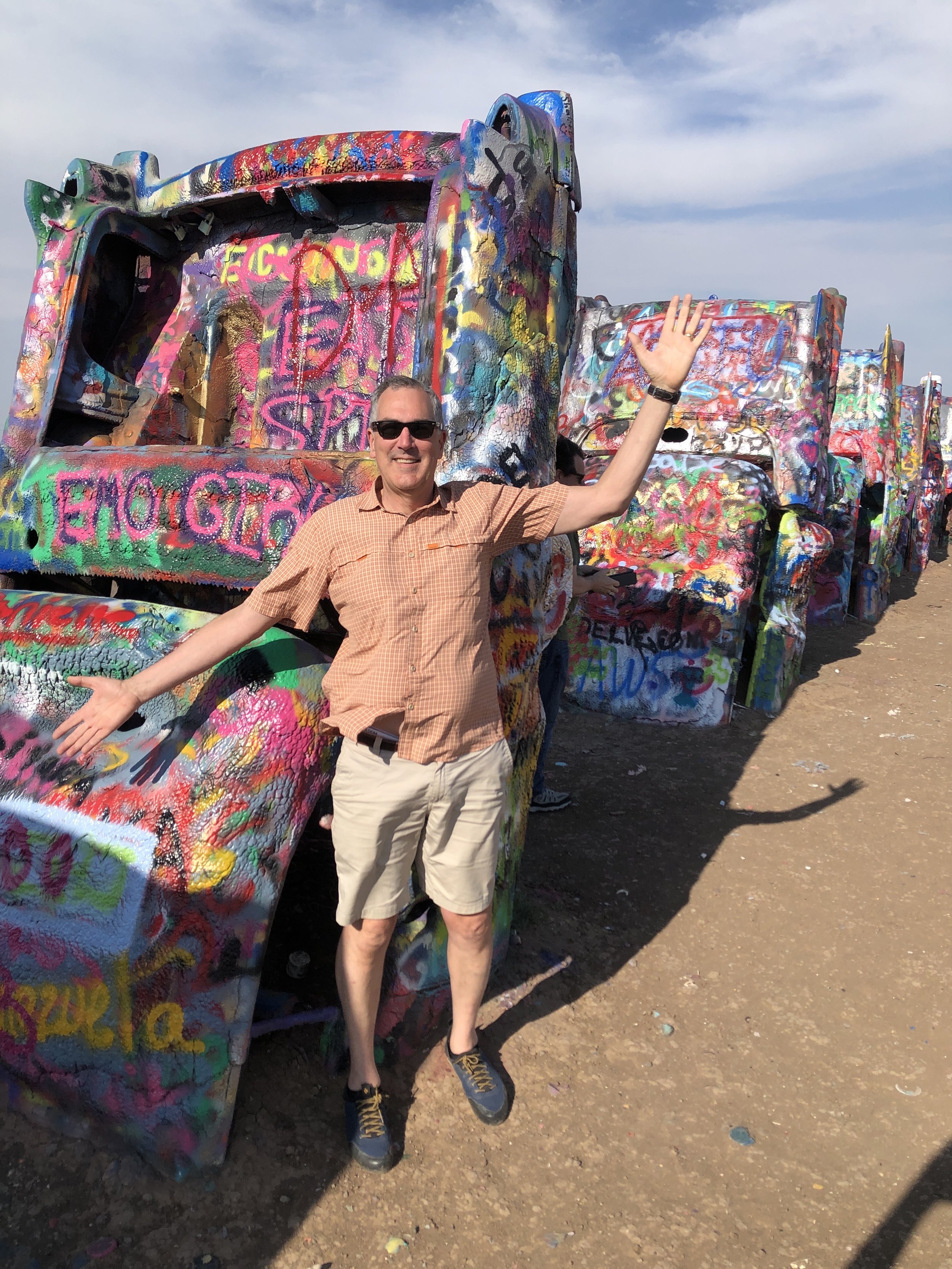
A field just west of Amarillo has an unusual landmark -- a line of ten brightly colored Cadillac automobiles rises from red-brown soil. Buried nose-first and at a slight incline, the oldest was manufactured in 1949 and the youngest in 1963. Dubbed “Cadillac Ranch” the garish monument was created in 1974 by a group calling themselves Ant Farm. Originally located in a wheat field near downtown Amarillo, the cars were relocated to a frontage road adjacent to Interstate 40. Although located on private property, visits from the public are encouraged. After parking we walked past a trailer where visitors can purchase souvenirs and cans of spray paint to leave their own mark on the cars.
We made a final stop at Amarillo’s famous restaurant, “The Big Texan.” On one side of the restaurant and visible from Interstate 40 is an eighteen-meter-high sign featuring a bowlegged cowboy. When it opened in 1960 on U.S. Highway 66, hungry cowboys competed to see who could consume the largest meal. After one ate a 72 ounce (2 kilogram) steak and all of the “fixins” in 1962, Big Texan owner Bob “R J” Lee stood on a chair to announce the restaurant’s steak challenge: anyone who could finish a 72 ounce steak, baked potato, salad, and bread roll in less than an hour would eat for free. In September 1963, a 202 kilogram wrestler named Klondike Bill finished two complete steak dinners in under an hour. Since the contest began, more than 92,000 people have attempted to eat the colossal meal. About 10,000 (11%) have been successful. After waiting for fifty minutes, we were seated in a booth located within a small alcove. From our vantage point we could see dozens of large tables crowded with restaurant customers as well as the food preparation area where steaks were being cooked. I ordered a 12-ounce ribeye that came with a choice of two sides and a bread roll. As I ate, I tried to imagine consuming a steak six times larger than what was on my plate. Our meal was excellent, and I made a mental note to return on my next trip to Amarillo.


