Spain and Morocco. From the Pillars of Hercules to the Barbary Coast
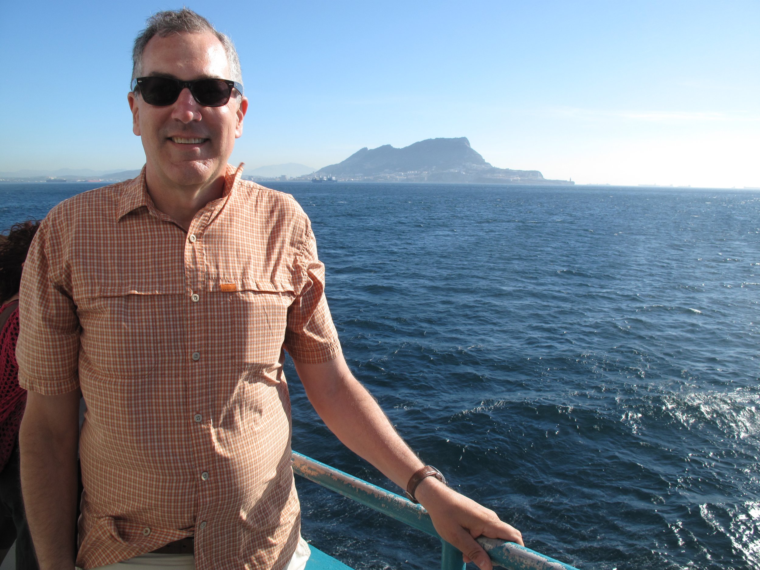
According to Greek mythology, the Pillars of Hercules marked limits of the known world. Named Mons Calpe and Mons Abila, the pillars were mountains on each side of a narrow gap separating the Mediterranean Sea from the North Atlantic Ocean. Contemporary scholars believe that the northern pillar (Mons Calpe) is the Rock of Gibraltar, and the southern pillar (Mons Abila) is either Monte Hacho or Jebel Musa in North Africa. At its narrowest point between Punta de Tarifa in Spain and Point Cires in Morocco, Europe and Africa are just 14.5 kilometers apart. Today, we know the gap separating the two continents as the Strait of Gibraltar.
Establishing an outpost in the first millennium BC, the ancient Phoenicians recognized the Strait’s military and commercial importance. Indeed, the gap was the only sea passage out of the Mediterranean Sea until completion of the Suez Canal in 1869. During World War II, German U-boats (submarines) passed through the strait on their way to the Mediterranean. With intense surveillance by the British Navy, nine U-boats were destroyed during the war as they attempted to pass through. More recently the U.S. Navy has monitored the strait in an effort to detect Russian submarines entering the Atlantic. Today, approximately 70,000 ships pass through the strait each year on their way to ports in the Middle East, Africa, Asia, North America, or Europe’s Atlantic coastline.
The strait is named after the nearby Rock of Gibraltar. Marking the southern tip of continental Europe, the 426 meter high limestone promontory falls within a small territory of the United Kingdom. The name “Gibraltar” comes from the Arabic, “Jabal Ṭāriq” (Mountain of Tariq). Our ferry departed from the Spanish port city of Algeciras, located on the west side of the Bay of Gibraltar. Following the one-hour trip across the strait, we disembarked at a small harbor adjacent to the City of Ceuta. Located on a narrow isthmus between Mt. Hacho and the mainland, Ceuta has a tumultuous history. Following the destruction of Carthage in the Punic Wars (264 BC to 146 BC), northwest Africa became a client state of Rome. In subsequent years lands north of the strait were controlled by the Vandals, the Byzantines, and native Amazigh tribes. Following a sea attack in 1415, the Portuguese took control of the settlement known today as Ceuta and in 1668, the city and surrounding lands were ceded to Spain as part of the Treaty of Lisbon. Seeking to retake Ceuta, Moroccan military forces under Moulay Ismail repeatedly attacked the city between 1694 and 1727. Extending over thirty-three years, the attacks are considered the longest siege in history. In 1936, General Francisco Franco used Ceuta during an airlift to transport rebel nationalist troops and supplies from North Africa to Spain during the Spanish Civil War. Finally, in 1956 Spain recognized Morocco’s independence but held on to its North African possessions. To this day the Moroccan government makes frequent requests for Ceuta to be returned.
Today, Ceuta is an autonomous city and one of three Spanish territories in Africa that include the Canary Islands and the nearby city of Melilla. Five centuries of European control have given Ceuta a European appearance. Its population (85,000) is a blend of Christians and Muslims with Spanish and Arabic serving as the principal languages. Ceuta is also a destination for Africans hoping to reach Europe. To stop the flow of migrants and discourage smuggling, a two-meter-high fence topped with barbed wire separates Ceuta from Morocco.
Our bus continued on to the Moroccan city of Tétouan, located forty kilometers south of Ceuta. Unfortunately, the border was at a heightened level of security because of a bombing in Manchester, UK a few days earlier. A line of cars, trucks, and buses waiting to cross was backed up for more than four kilometers. Unknown to us, our bus driver called the owner of his company who arrived on a small motorcycle. Motioning for us to follow, the bus company owner pulled into the lane going the opposite direction and past the line of motionless vehicles. As we followed the motorcycle, angry drivers shouted and shook fists. Arriving at the border, Moroccan border guards processed our passports and searched the bus before waving us through.
The name “Tétouan” means “the eyes” in the native Amazigh language. Located in the Martil Valley, the city (population 380,000) is one of two major ports on Morocco’s Mediterranean coast. Tétouan has a fascinating history. During the thirteenth century, the Marinids constructed a casbah and mosque there and beginning in the early sixteenth century, the city became a focal point for piracy. With Spain and the Ottoman Empire locked in conflict over the western Mediterranean, pirates (aka corsairs) roamed the Barbary Coast (modern Morocco, Algeria, Tunisia and Libya). Captives from ships taken by pirate vessels were held in mazmorras (underground cave complexes) that were sometimes equipped with churches and mosques. Prisoners held in a mazmorra could be released if their family paid a ransom. Between 1913 and 1956, Tétouan served as capital of Spanish Morocco. Today, large houses owned by wealthy families line the city’s wide boulevards. The road into Tétouan is flanked by pomegranate and orange orchards. We visited the city’s small but authentic medina. Surrounding the medina is a five kilometers long wall that is interrupted by seven gates. In its early years, the medina had an important economic function as the main point of contact between southern Spain and Morocco. Before stopping for lunch, we browsed shops featuring textiles, leathergoods, and jewelry. The delicious local cuisine is influenced by Amazigh, Arab, Moroccan, and Spanish culinary traditions.


