Cameroon. Mt. Cameroon and the Eighteenth-Century Slave Port of Bimbia
Cameron is a nation of deserts, beaches, rainforests, savannas, and mountains. The country’s 475,000 km2 is twice the size of the United Kingdom, but accounts for just 1.6% of the total area of Africa. The country’s varied physical landscape is matched by its ethnic diversity with large Christian and Muslim populations and more than 250 native languages. It is no wonder that Cameroon is known as “Africa in miniature.” Although I was looking forward to learning about Cameroon’s landscape and culture, my trip to western Cameroon was driven by a research project about eighteen century slavery in West Africa.
Our flight from Paris terminated at Douala International Airport, located in the southern part of the city and near a tributary of the Wouri River. The country’s second largest city, Doula (2.7 million), was founded on a section of the Gulf of Guinea known as the Bight of Biafra. The site was first settled during the Neolithic era. Portuguese sailors who visited during the fifteenth century named the large river adjacent to the settlement Rio des Camarões, meaning “river of shrimp.” During the 1600s, settlers from the Congo migrated into the region and by the eighteenth century, the area was a center for the transatlantic slave trade. In 1868, Germans established a warehouse on an estuary of the Wouri River. With the arrival of additional settlers, German Chancellor Otto von Bismarck approved the creation of a colony called Kamerun. Using forced labor, the Germans operated rubber, palm, oil, and banana plantations.
Following Germany’s defeat in WWI, Kamerun was divided into territories administered by France and the United Kingdom. French Cameroon became independent in 1961 and a decade later the country’s two halves reunited. Today, Cameroon’s population of twenty-seven million is evenly split between urban and rural areas. Christians make up two-thirds of the population and Muslims, about twenty-one percent. A substantial percentage of the country’s population is dependent on subsistence farming, growing crops such as maize, millet, plantains, rice, and potatoes.
Located near Doula, Mount Cameroon (4,040m), is the highest point in sub-Saharan western and central Africa and part of the Cross-Sangana-Bioko coastal forest ecoregion. Of volcanic origin, the mountain last erupted in 2000. Since 2009, the area has been protected within the 581 km2 Mt. Cameroon National Park (aka Parc National du Mont Cameroun). Our partial ascent of the mountain began in a lowland rainforest that extends from sea level to eight hundred meters. Believed to be the first European to climb the mountain, Mary Kingsley described her adventures in the book, Travels in West Africa (1897). We passed massive evergreens and emergent trees that pushed above the main canopy. Accompanied by a local guide, we followed the trail through lower montane forest that is interrupted by scattered scrublands and meadows. Wearing hiking boots with soles well past time to be replaced, I fell on the slippery trail (wearing flip-flops, my guide never fell!). The route continued upwards into upper montane scrub and subalpine grassland. This portion of the mountain has populations of African forest elephant, chimpanzee, blue duiker, and bushbuck. At 1,850 meters we made a thirty-minute stop at a rest hut before heading back to our vehicle.
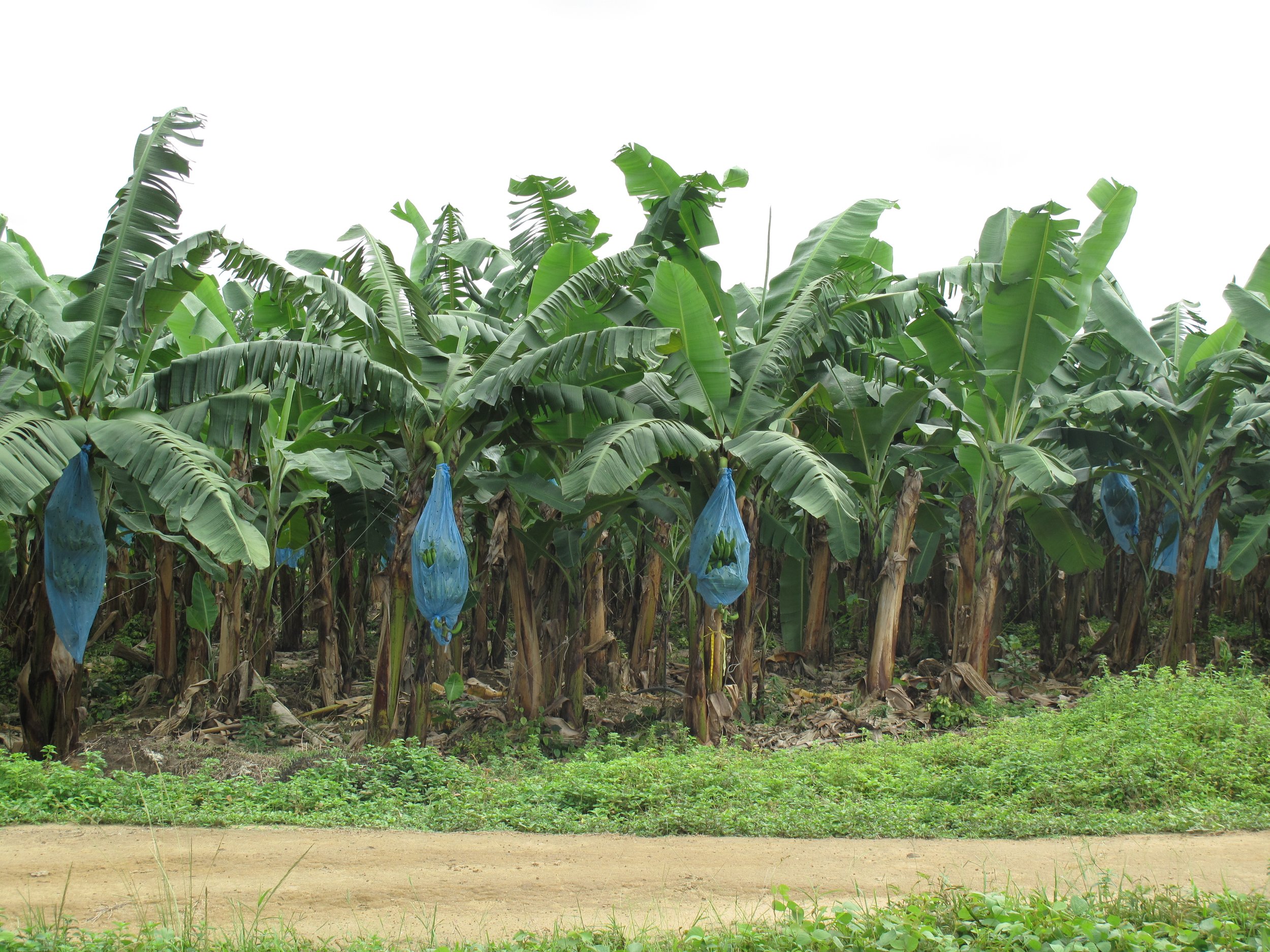
Returning to our hotel, we paused at a coastal inlet with a view of a large offshore drilling rig. The “jack up” rig we saw can be self-elevated (jacked up) from the seafloor and used for both drilling and pumping crude oil. With two hundred million barrels of proven reserves, Cameroon exports more than 50,000 barrels a day (2023 data), making crude oil its most important export product followed by timber and bananas. We stopped for a photograph of a banana plantation where blue bags had been placed over bunches of bananas for protection against sunlight and insects. Cameroon is the world’s fifth largest exporter of bananas. The country’s other agricultural export crops include palm oil, rubber, tea, coffee, sugar, groundnuts, rice, and cotton.
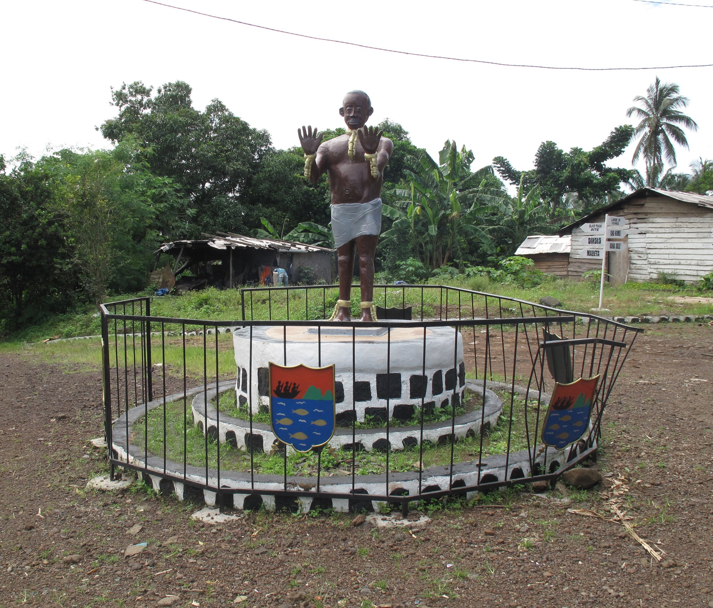
Our most important stop was the eighteenth century slave port of Bimbia. Less well known compared to Senegal’s Gorée Island or Ghana’s Cape Coast Castle, the Port of Bimbia was used for shipping tens of thousands of captive Africans to the Americas. On our way to the former port, we drove through the seaside town of Limbe and a section of the Bimbia Bonadikombo Community Forest. The ruins of Bimbia were discovered during work to uncover a Baptist church built by Alfred Saker (1814-1880), a well-known British missionary. The last twelve kilometers was a dirt road filled with potholes. We parked near a small blue sign marking the site and followed a two kilometer path through bamboo and other vegetation to foundations and concrete pillars from the eighteenth century slave port. The site has a sad and violent history. Although some captives were brought from nearby villages, most were forced to walk hundreds of kilometers while chained. Near where we stood, thousands of women and children were murdered while healthy males were forced into slave ships bound for more than thirty countries. Remarkably, we found a few heavy chains still attached to pillars and building foundations.


