Colorado. From the Rim Road’s Rocky Sentinels to the World’s Largest Flat-topped Mountain
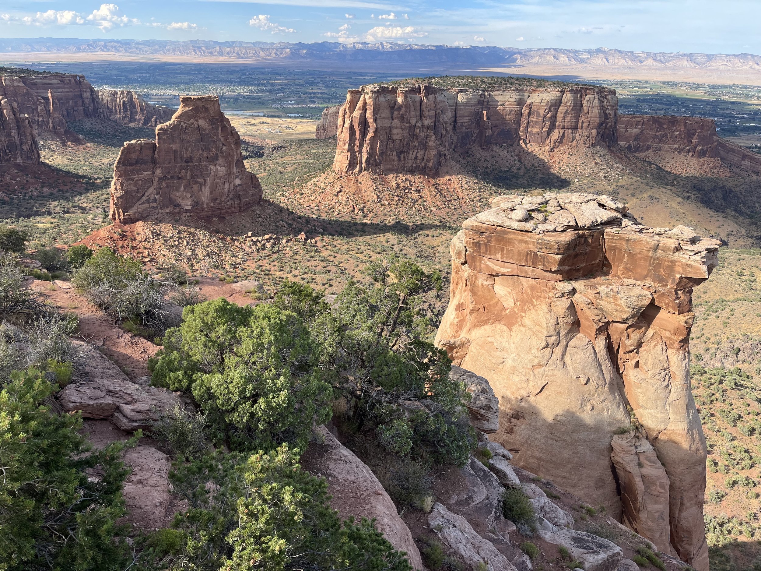
West of Grand Junction, Colorado is a high plateau that terminates at a jagged cliff of exposed Wingate and Kayenta sandstone. In a few placed detached remnants of higher ground extend upward from the valley floor as flat-topped buttes or thin spires. The canyon’s breathtaking panoramas have drawn comparisons with Arizona’s Grand Canyon. Today, portions of the plateau and canyon are protected within the 83 square kilometer Colorado National Monument (CNM). Although I’d been to the monument before, I was excited to see it again.
Humans have occupied canyons within the present-day monument for more than 10,000 years. Small groups of nomadic hunter/gatherers left behind Clovis and Folsom spear points. Sometime around 400 AD indigenous bands adopted a more sedentary way of life. Building check dams and hearths, Anasazi farmers lived there until 1250 AD. More recently, Ute and Navajo peoples settled in the area. Small groups of Utes occupied the canyons until 1881 when they were moved to reservations by the U.S. Army. During the early 1900s Missouri native John Otto became the first person of European descent to explore the area. Arriving in 1906 to work on an irrigation project, Otto wrote, “I came here last year and found these canyons, and they felt like the heart of the world to me.” Soon he began work on trails through the canyon and across the plateau. Later, he wrote letters and editorials suggesting that the area be protected. On learning about Otto’s work, a local newspaper began lobbying for the area to be designated as a national park. In 1911, President Howard Taft used the Antiquities Act to designate the area as a national monument that would safeguard, “…extraordinary examples of weathering and erosion.” Soon after Otto was hired as the monument’s first ranger. Today, Serpents Trail follows Otto’s original route to the top of the monument’s plateau. Along with colorful rock formations and panoramic vistas, the monument is known for a bicycle race called “Tour of the Moon,” first held in 1980.
Like many other U.S. national park sites, Colorado National Monument was transformed by the Civilian Conservation Corps (CCC). The CCC established three camps there, the first in April 1933. Men enrolled in the CCC for six months and worked in groups of 200. The principal project at CNM was the 37-kilometer Rim Rock Drive. Although some work was done with explosives, the lion’s share was completed by hand with shovels and pickaxes. The completed road had three tunnels, 200 culverts, and six overlooks. Some of the most visible reminders of CCC can be seen in rock walls located at overlooks. CNM is made up of six canyons, each with unique cliff faces and sandstone monoliths. Geologists have noted that schist and gneiss rock found within the monument is from the early to middle Proterozoic while horizontally bedded sedimentary rock is from the Mesozoic period. There are also deposits of alluvium, former dune sands, and thrust faults. Over millions of years, volcanic processes reshaped the landscape as inland seas have come and gone. More recent changes have taken place through wind and water erosion.
The monument has two entrances, one to the north near Fruita, and the other adjacent to Grand Junction. Most travelers need two to three hours to navigate the Rim Road. Traveling on U.S. Interstate 70, we entered the monument at the Fruita entrance. The sometimes-narrow road passes through short tunnels on its way upwards. After settling in at Saddlehorn Campground we walked to the Book Cliffs Viewpoint. The next morning, we began driving the main part of the Rim Road. Passing the visitor center, we stopped at Independence Monument Overlook. Rising 137 meters above the valley floor, Independence Monument is CNM’s tallest and most iconic formation. Each July 4th a small group of climbers unfurl an American flag on its summit. The monument’s wind and water sculpted features include Pipe Organ, Window Rock, Kissing Couple, Praying Hands, and Sentinel Spire. We continued driving the Rim Road with stops at Grand View, Coke Ovens, Artist Point, and Upper Ute Canyon overlooks.
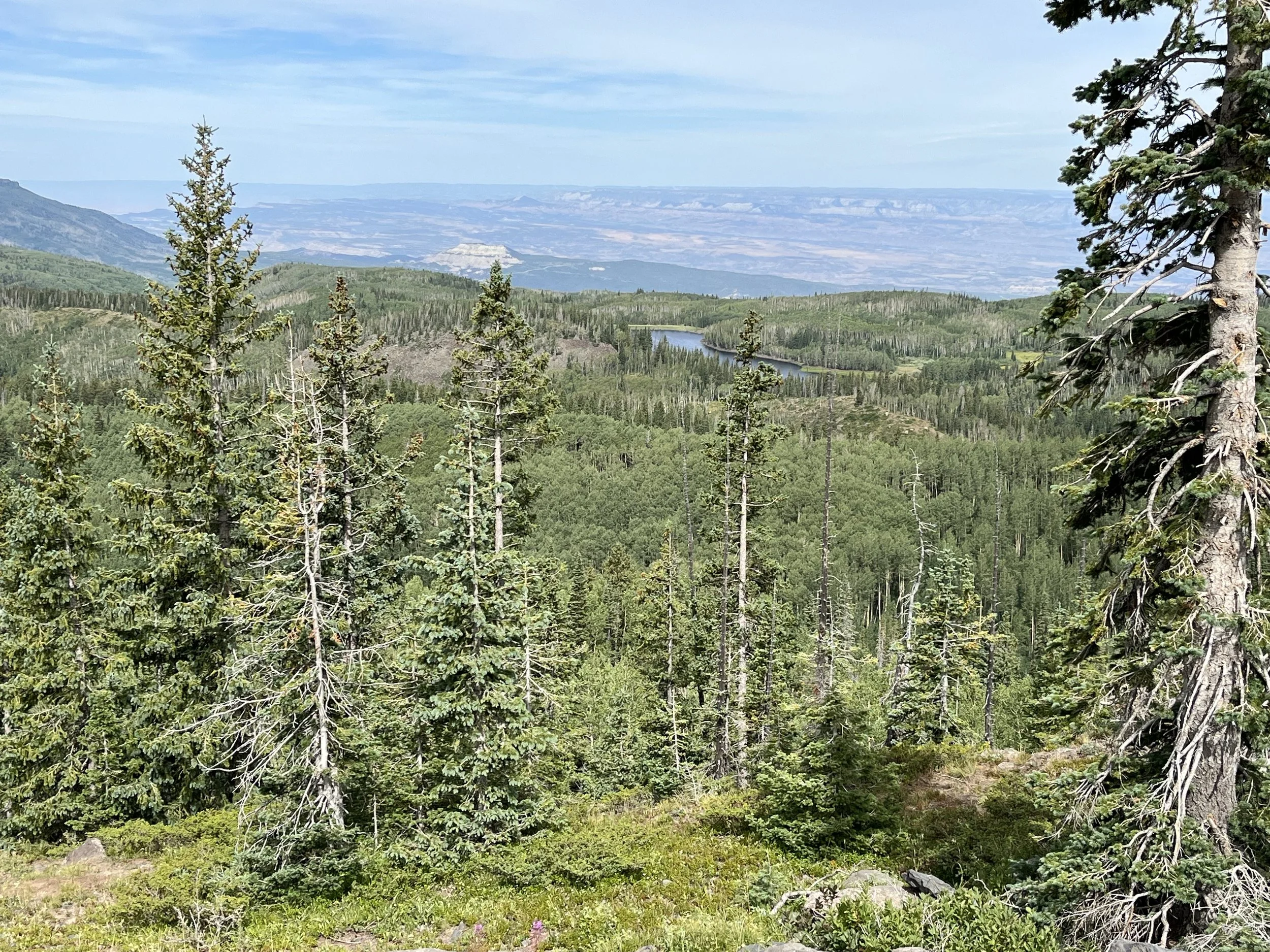
After completing the Rim Road, we passed through Grand Junction westbound towards Interstate 70 and Grand Mesa. Grand Mesa is the largest flat-topped mountain in the world. Located at 3,050 meters above sea level, the mesa encompasses an area of more than 1,300 square kilometers. Spread across the top are more than 300 lakes, many containing rainbow, cutthroat, and brown trout. The area also has mountain lion, elk, coyotes, and deer. Passing through national forest land, we followed the 100-kilometer Grand Mesa Scenic Byway that combines Colorado State Highway 65 from Cedaredge to Interstate 70 and Forest Service Road 100 to Land’s End Observatory. Driving to the top of the mesa, we passed a turnoff to Powderhorn Ski Area. The Land’s End overlook offered excellent views across an enormous valley.
Dotted with aspen and pine, the mesa rises 1,800 meters above surrounding river valleys. Administratively, it is located within Grand Mesa National Forest. The mesa is capped by a 90-meter layer of volcanic basalt that was formed by lava flows more than ten million years ago. The volcanic rock sits over much older layers of shale and sandstone. At 3,220 meters above sea level, the mesa’s top has an alpine climate and during winter months it can be covered by up to 750 centimeters of snow.


